

Black Oak (Windsor Ontario)
View Larger Map
Black Oak (also known as Morton Terminal is the single best mountain bike trail in Windsor. While, like the rest of Essex County, it is somewhat "vertically challenged" due to the lack of any real hills, it contains a 5.7km long stretch of swoopy and fast singletrack that makes for a great ride. Of all the trails I have ever ridden, this one has by far the best flow to it. Ridden hard, it is like a mountain biking autocross run.
The trail is maintained by a small group of volunteers who have an understanding with the park ecologist. The trail is allowed to exist, so long as it is not expanded or added to in any way. It snakes its way through the oaks and the remains of the abandoned rail yard (what the land was before it became a park), and while it is not very technical from a difficulty standpoint (it is a green trail by IMBA standards; nothing more challenging than a couple of log rolls) the flow and sheer length more than makes up for that.
The trail is marked by green blazes and arrows in most places, particularly at control points. There are walking trails and game trails throughout the park and the mountain bike trail occasionally crosses them - look for the blazes to see where to go. The trail can get obscured by leaves in the fall, but it is frequently raked.
While there are no race events held in the park, there is an Internet Time Trial (basically, a list of personal best times to complete the trail). For more info, see the thread at The Bicycle World Forums.
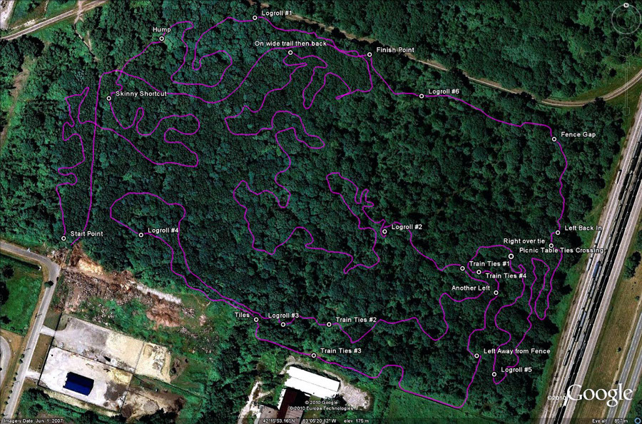
Download the course in Google Earth format.
There are some guidelines for using Black Oak:
- In the summer, the park is mostly left to the mountain bikers. In the fall though, the "leaf watchers" come out and can be found ambling through the park, often in the company of unleashed dogs. They can be profoundly ignorant of what the mountain bike trail is and can occasionally be found on the time trial course. Be aware that they may be there and be ready to stop.
- The park naturalist takes a very, very dim view of additional construction. DO NOT expand or modify the trails, build jumps, or otherwise "improve" the trail. Deadfall and leaves may be moved off the trail, but that's it - keeping this trail depends on us being good neighbours and playing well with others!
- There are no garbage cans in the park, so carry out whatever you take in. If you find garbage, pick it up and carry it out.
- The trail surface drains very quickly and doesn't really get muddy. If, however, the trail is soft enough to leave ruts (especially in spring), please come back another day; the ruts will harden to concrete and will last all season.
- Please attempt to avoid skidding, especially when the course is dry, as it tears up the trail.
Key Points
This way to the start point. The trail is mostly marked with green blazes and arrows painted on trees.
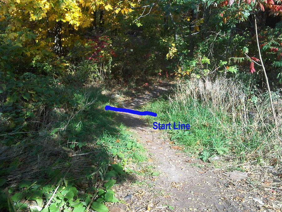
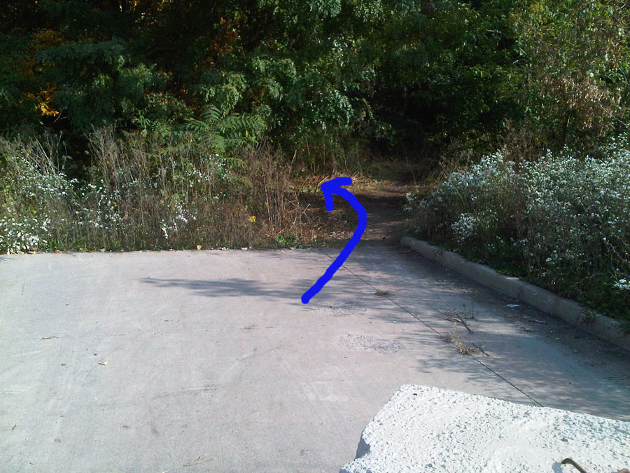
As you go left at the Y junction coming out of the parking lot, the start point is at the entrance to the curve as it turns right.
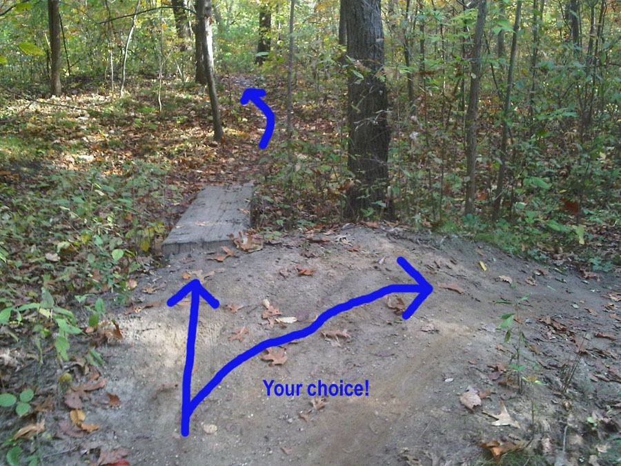
You have the option to ride the skinny straight or avoid it to the right. The skinny is a few seconds faster.
As you come down off the whoops, go over the hump to the right. The left side of the hump is a little easier.
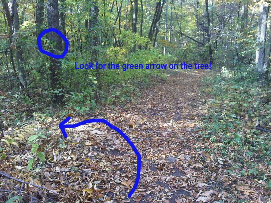
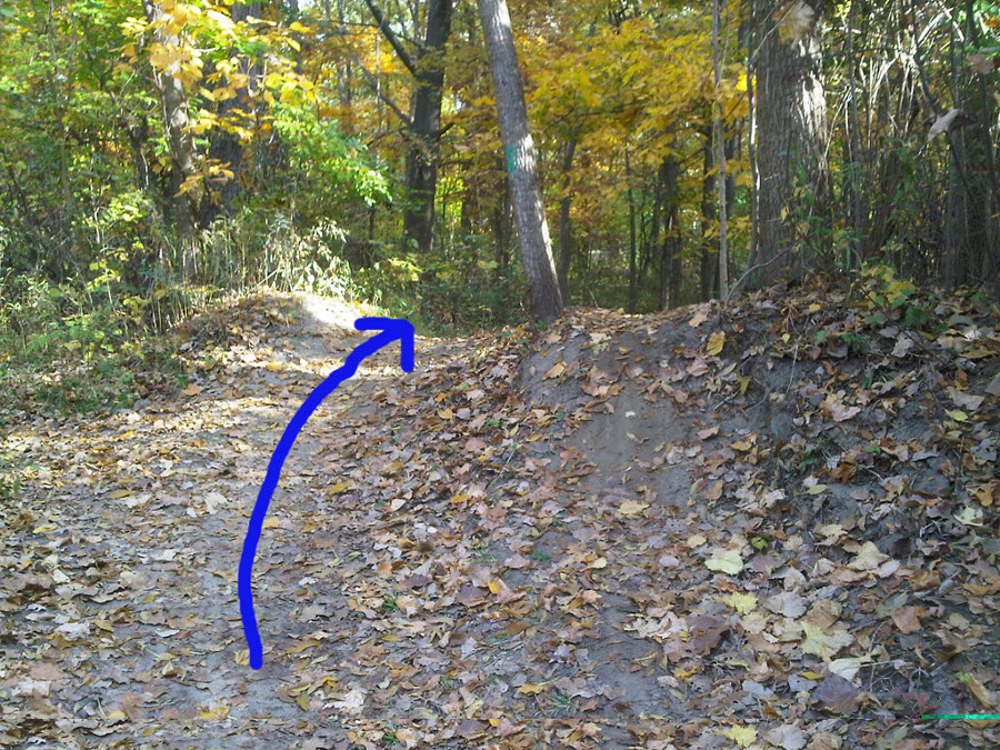
The trail pops up onto the wider, walking trail for a few feet. Drop back in on the left. There is a green arrow on the big tree, but it can be hard to see.
This logroll comes up suddenly around a blind switchback. It isn't tough to clear.
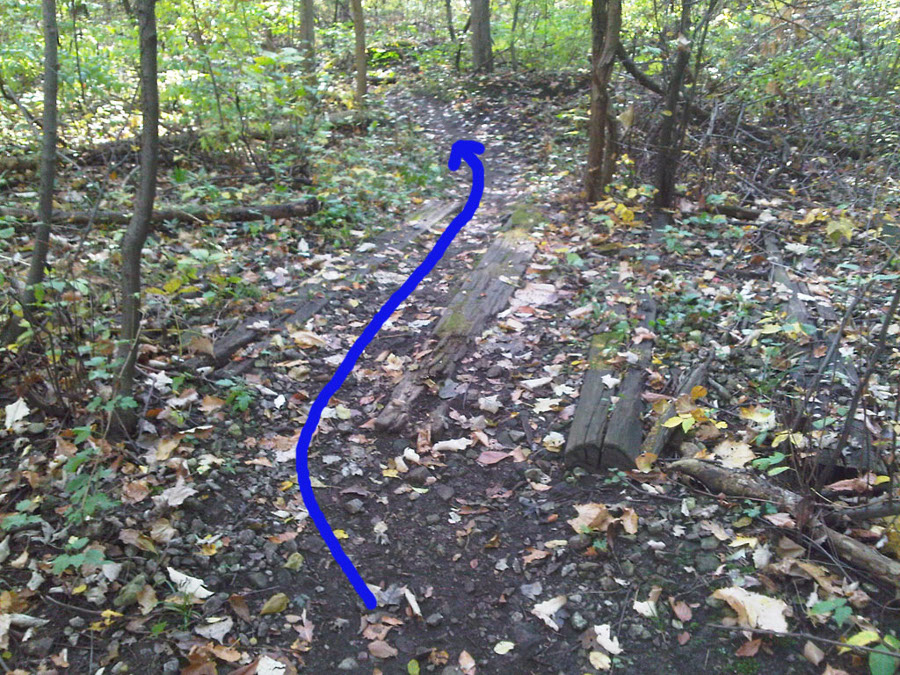
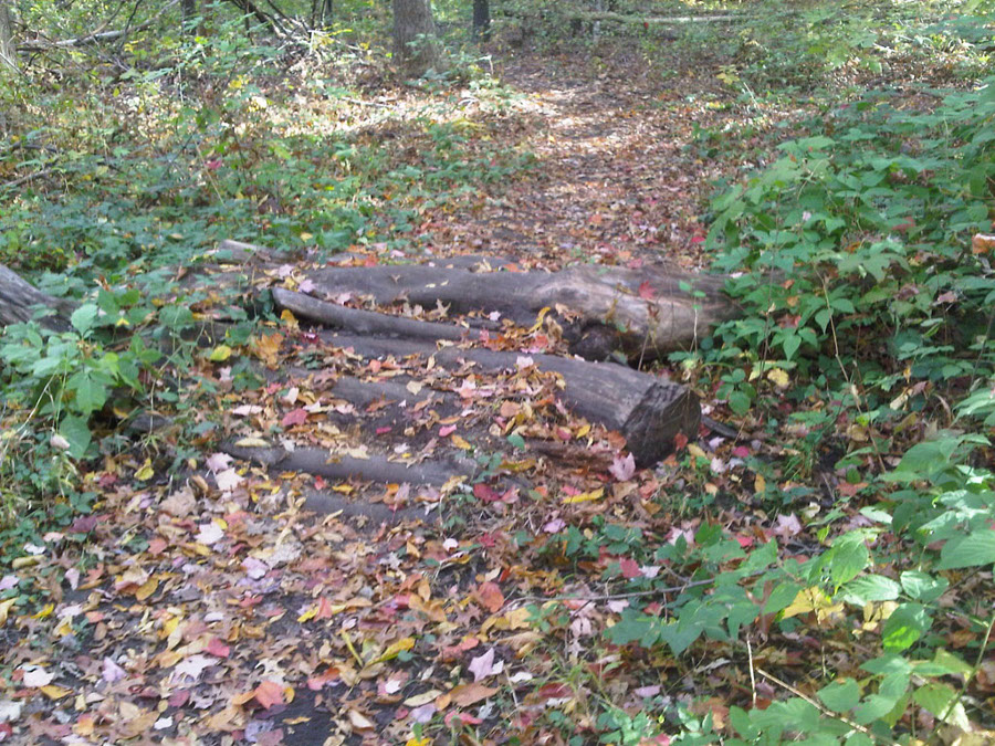
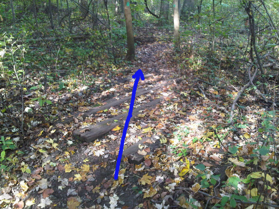
The first of many crossings over the abandoned rail lines. No rails, just ties.
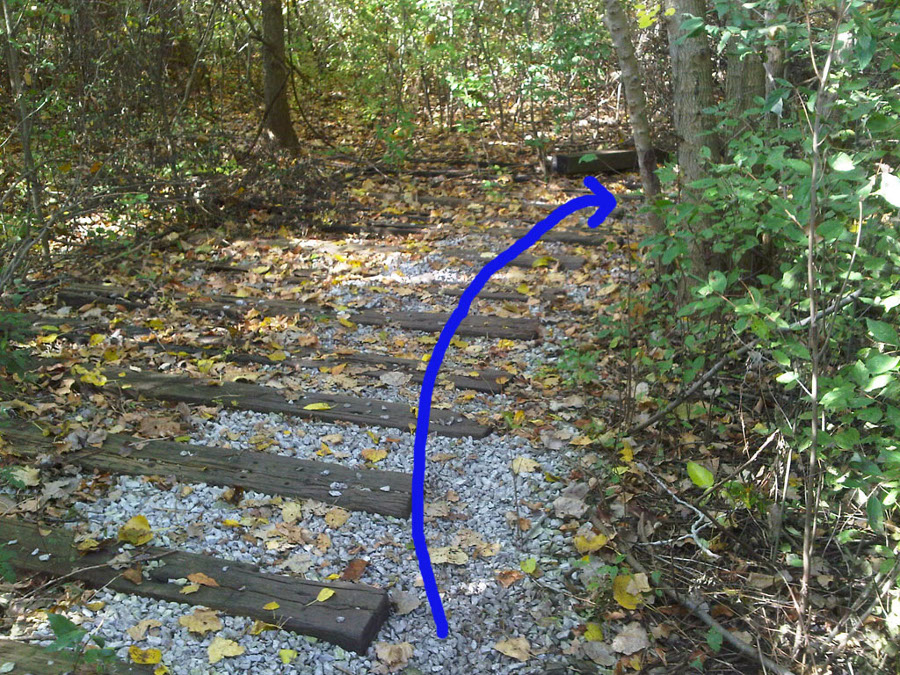
This crossing runs along the ties and then hooks right. It can be a little tricky if you aren't carrying speed. The faster you go, the easier this is.
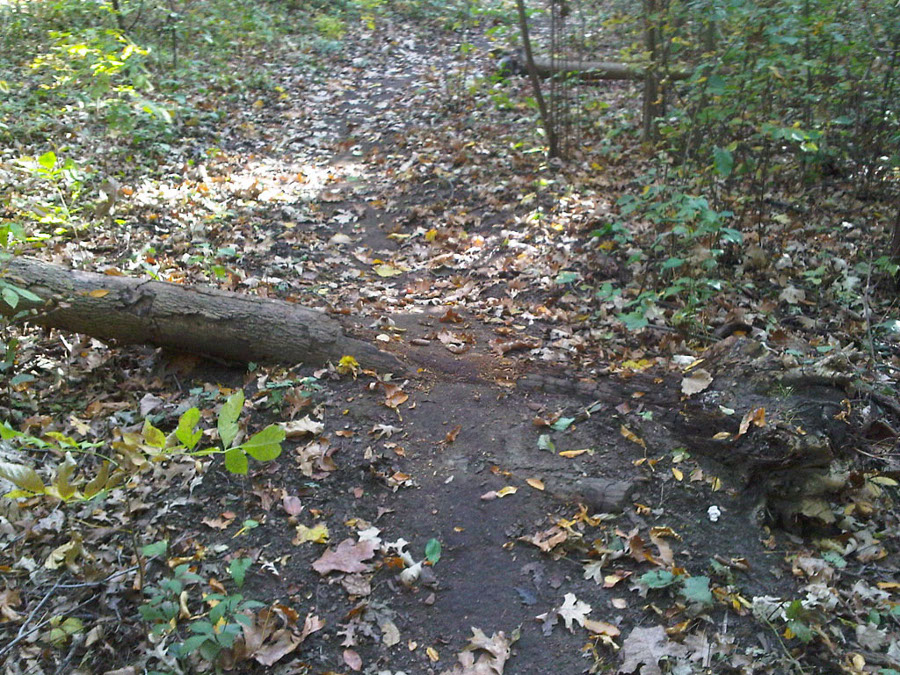
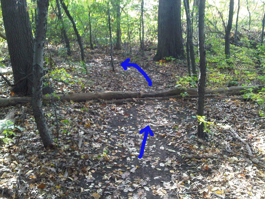
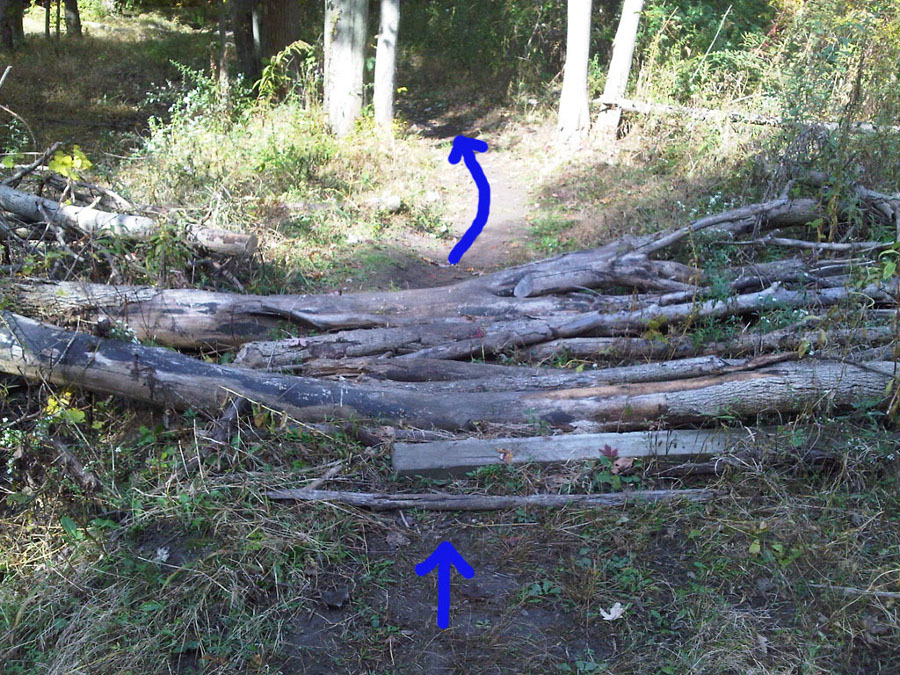
This logroll is on top of a little rise where the trail was re-routed to go around a downed tree. Be ready for it.
This logroll is so worn down you probably won't even notice it.
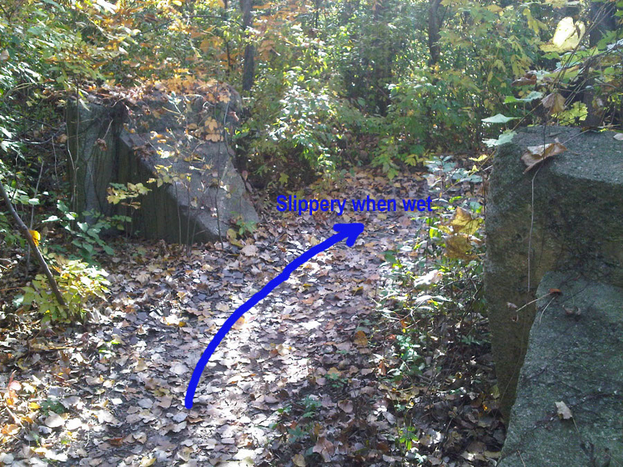
This section is covered in a thick layer of old bathroom tiles. They don't cut tires, but they can be slippery when wet.
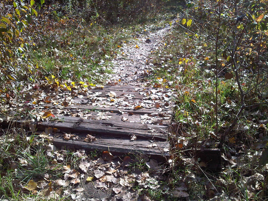
These ties bridge a section that still has its rails. Don't try and avoid the ties, or you'll hit rails!
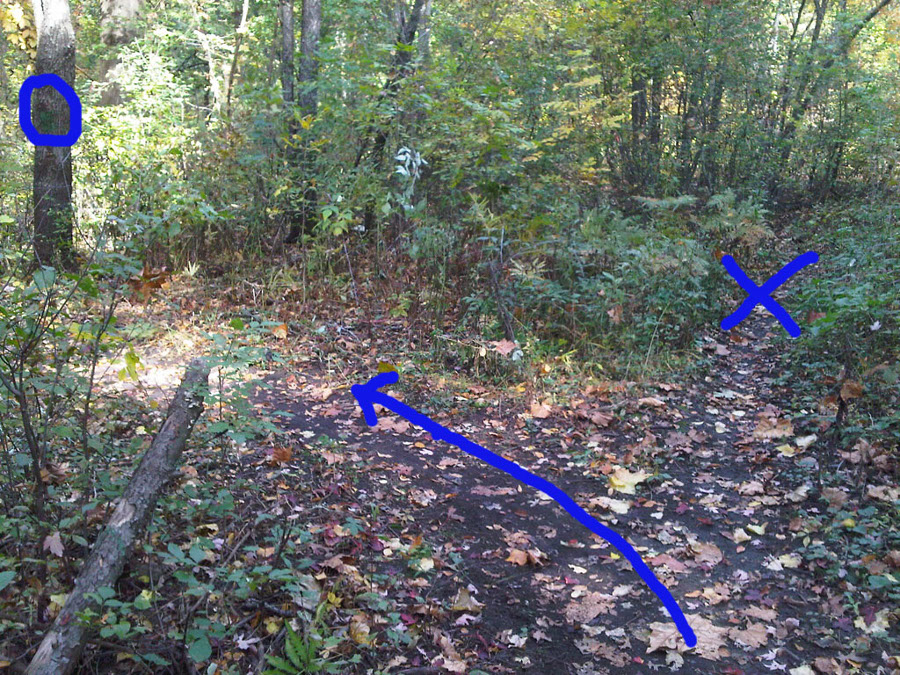
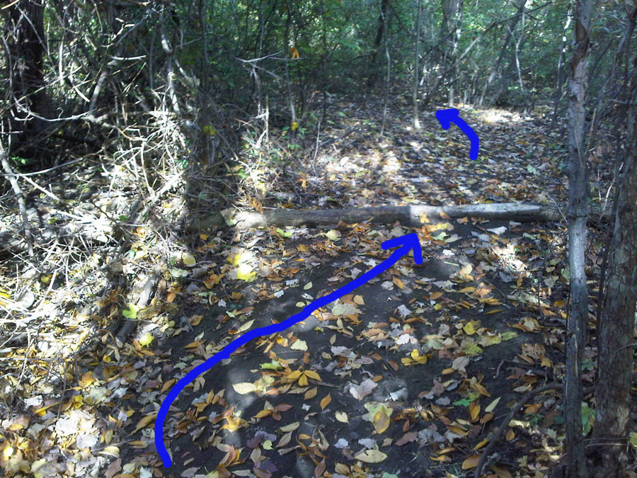
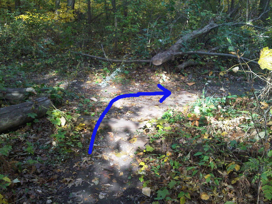
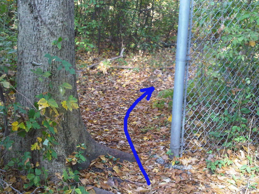
The path splits here; you can go straight along the fence, or cut left. Left is the way to go - look for the markings on the tree.
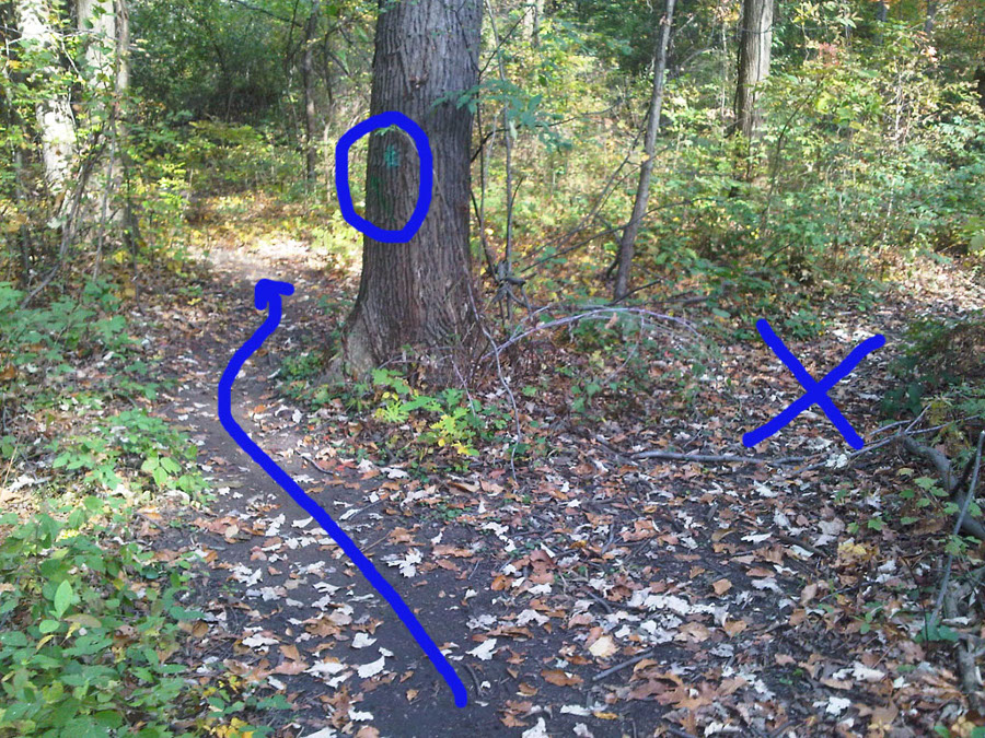
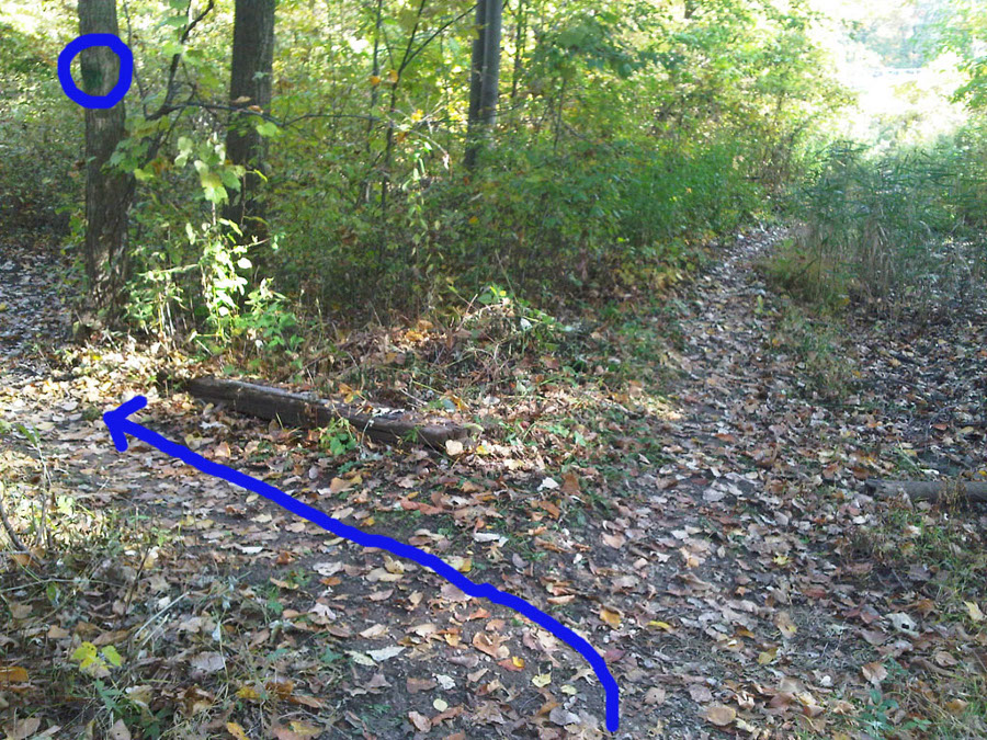
As the path rejoins the section that runs along the fence, cut back left again. Look for the blazes.
Another railroad crossing.
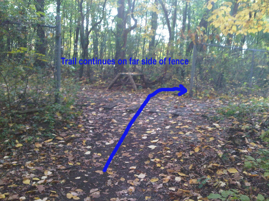
As you cross the ties, the trail cuts right on the far side of the fence.
This logroll is right at the entrance to a tight left-hander. Get your braking done as soon as you cross the log.
The path crosses a single buried railway tie and then cuts hard right.
Immediately following the right, the trail heads back into the woods on the left. Look for the markings. Heading straight takes you to Dainty Rice's railyard - don't go that way.
Scoot through the gap in the fence and cut right. Almost done!
This logroll looks more like a woodpile but it isn't as bad as it looks. Just a short sprint to the finish!
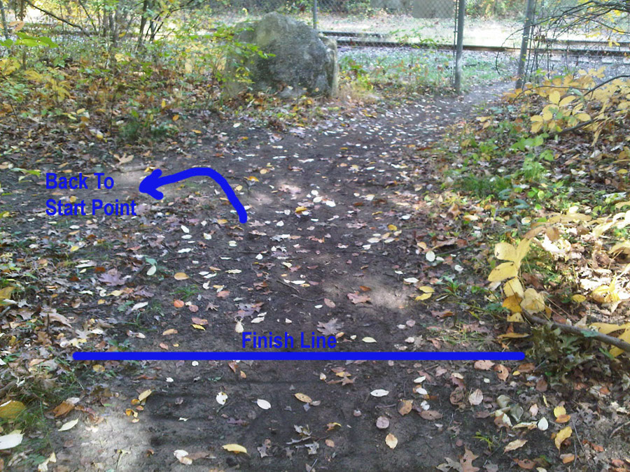
As you come up the rise, the finish line is on top of the little hill, as indicated. You can follow the trail left to get back to the parking lot.